
Written by Roger Lilley, Trustee
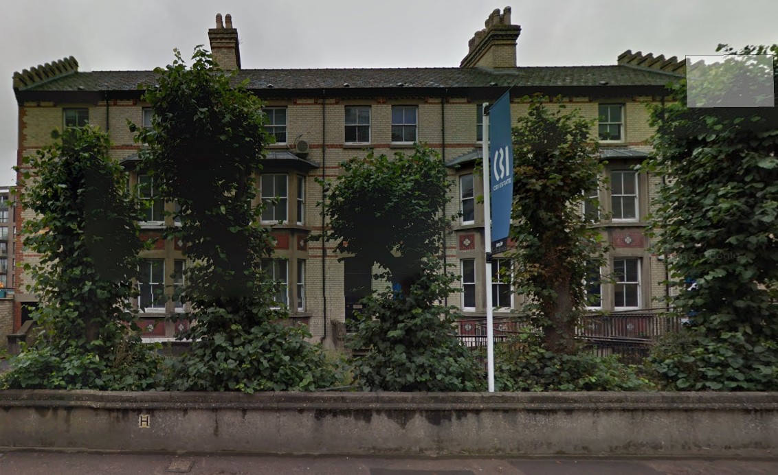
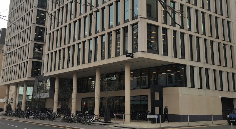
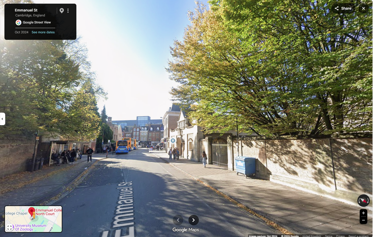
Buildings come and go, especially on busy commercial streets. Only yesterday I realised that a row of shops had literally vanished from just beside the University Arms Hotel in Regent Street. Next to the Botanic Gardens another enormous vanishing act has taken place over the last year with the removal of Betjeman House, leaving the Flying Pig as the forlorn survivor of the original streetscape. Just opposite we can stroll down Station Road and see on our left had side the row of surviving grand Victorian residences whilst opposite the street has been transformed into towering offices blocks over the last decade.
The roadways and their names usually survive and over the last ten years we have been plotting the buildings along these streets in Cambridge and beyond, both those that are there today and those that used to be, using contemporary and historic photos, recording their occupants and stories.
But there are some streets that have disappeared, in part or entirely. Russell Street off Hills Road was completely eviscerated in the 1960s leaving a little rump at either end, while the road and its rows of terraces disappeared under new social housing and St Paul’s school. Much of this reshaping of the urban landscape was justified as removal of slum and sub-standard housing, but it is interesting to reflect on how attractive and valuable the few remaining two-up two-downs have become today.
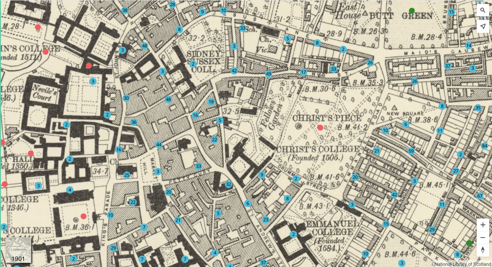
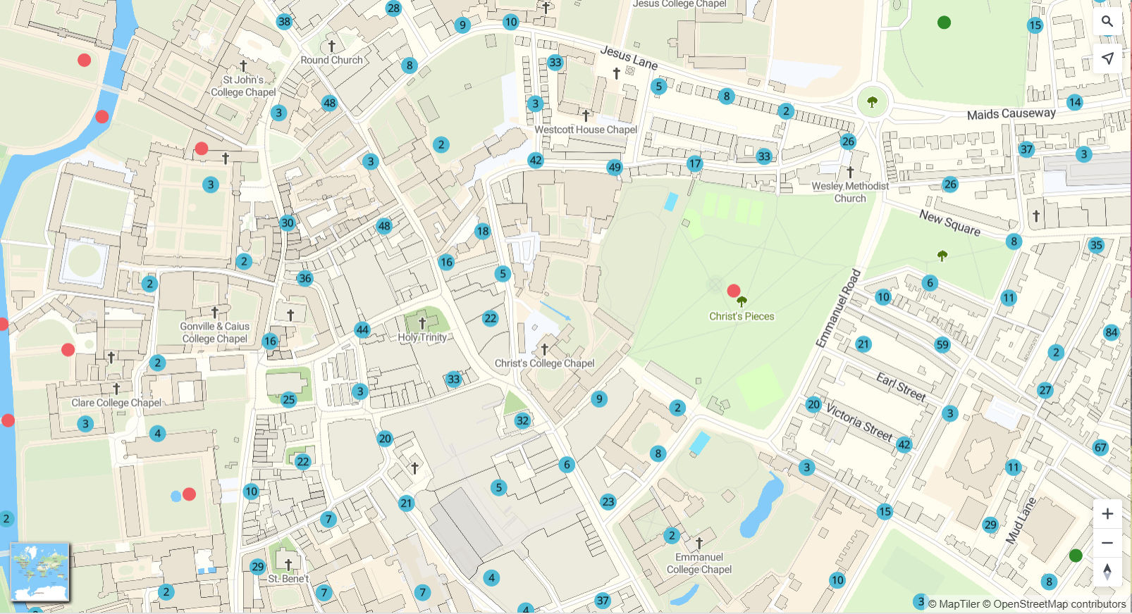
What we have recently done on Capturing Cambridge is use old Ordnance Survey maps to plot precisely where not only these vanished roads lay but also the individual houses, enabling an exploration of these lost communities. Communities such as those of Gothic and Doric Streets, which together with Terrace Lane formed one of the most densely packed streetscapes until total demolition after WWII.
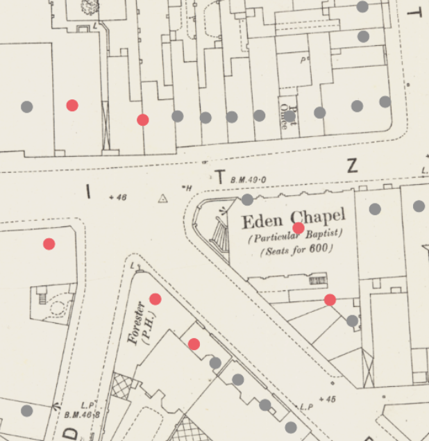
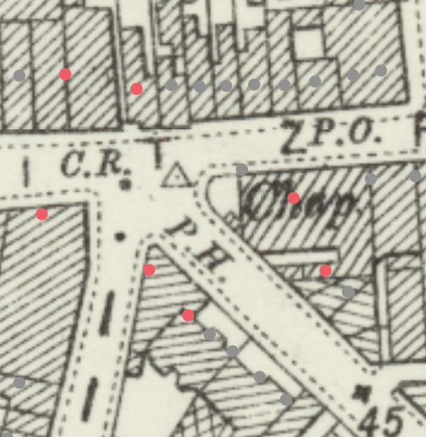
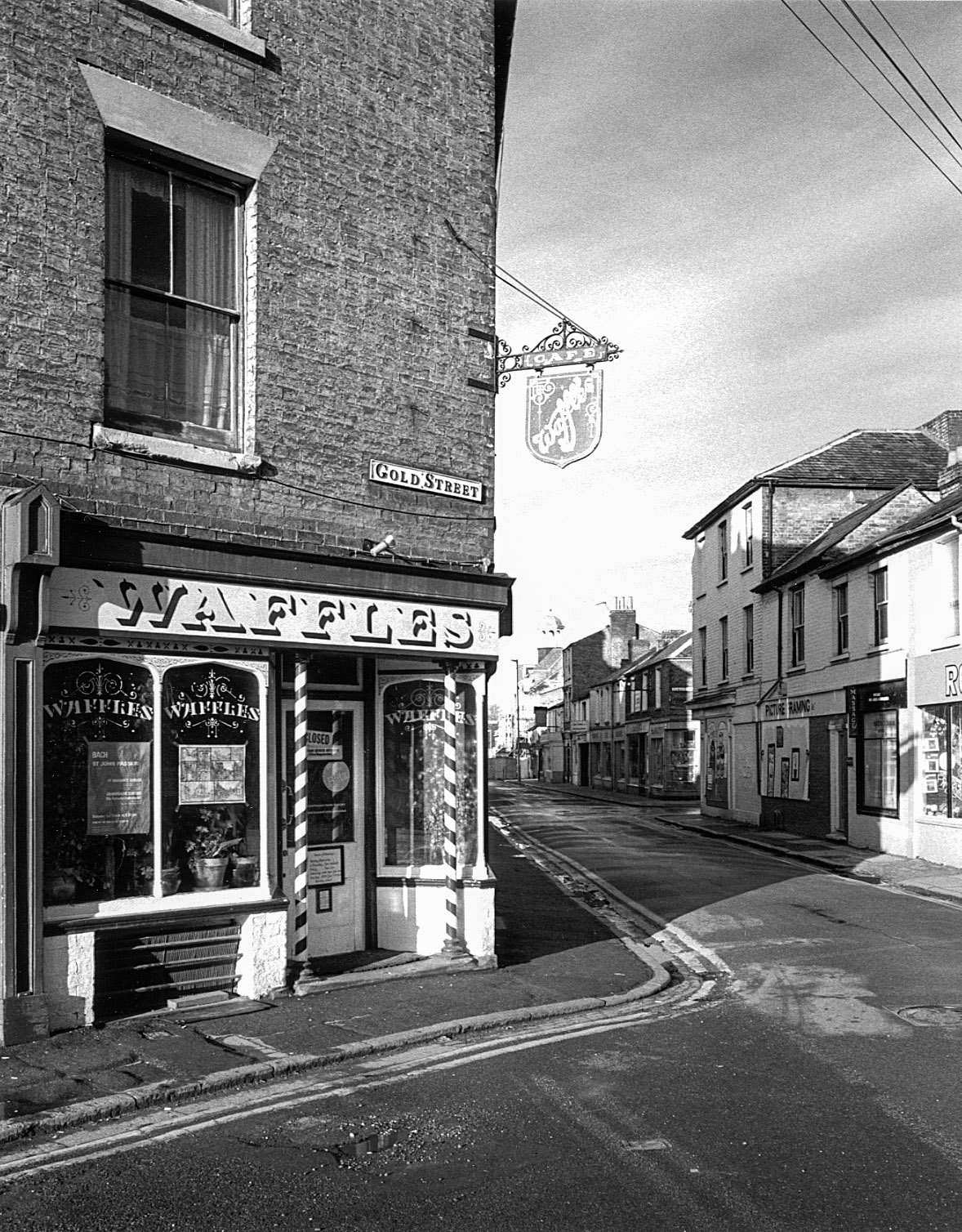
The most notorious destruction was that which took place around the Kite area which lay between East and Newmarket Roads. Whilst Eden Street and City Road survived unscathed, names such as Gold Street, and Nelson Street vanished forever and others, such as Fitzroy Street, James, Napier, Christchurch and Wellington were left as fractions of their former selves.
On the other side of East Road in the area around St Matthew’s church similar transformations took place. Staffordshire Street was entirely rebuilt; Gas Lane disappeared altogether.
We invite you to explore Cambridge’s lost streets. On Capturing Cambridge select the map option and then, at the bottom of the screen, one of the old OS map underlays, from either 1886, 1901 or 1965 to see just how much Cambridge has changed. Explore vanished roads and the families and communities who lived there. As always, if you have information, picture or reminiscences to add to our interactive map, or would like to contribute to our research, we would love to hear from you.
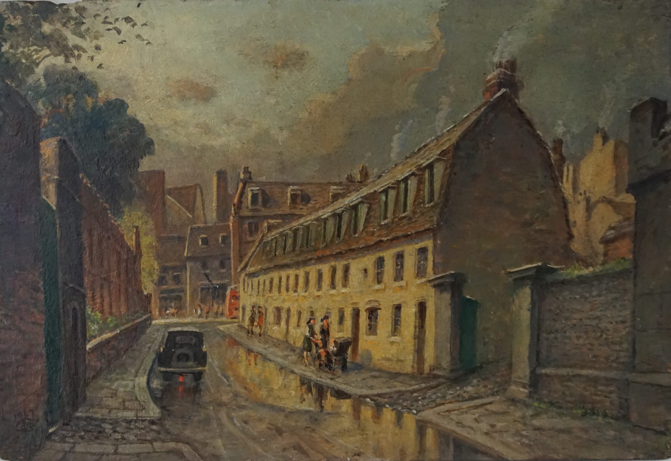
See more of the lost streets of Cambridge, captured by local artists in our new exhibition Portraits of Cambridge: a Town in Transition, open until 5th October 2026.
At the heart of the exhibition are artists who captured these changes as they happened. Mary “Polly” Greene features prominently, including her newly conserved works Albany Café and White Horse Inn, which bring moments of everyday Cambridge back to life. Alongside her, Marion Seward of the Cambridge Drawing Society, Robert Farren’s detailed etchings, and Henry Joseph Moule all record a Cambridge in flux, preserving buildings and streets that no longer survive. Together, their work forms a rich portrait of a changing town, inviting us to rediscover Cambridge through the places it has lost.
The Museum of Cambridge is the independent social history museum of the City and County of Cambridgeshire. As a registered charity the Museum relies on your support to enable volunteering opportunities such as this.
For more information on how to support the Museum of Cambridge’s vital work to preserve local history for future generations, visit www.museumofcambridge.org.uk or phone 01223 355159.